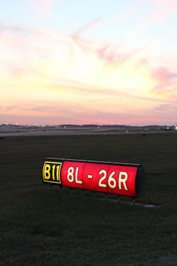
Managing utility, lighting and communication assets on the airfield is becoming a popular way to stretch the limited capital resources dedicated to the upkeep and operations of United States airports, especially those with a large geographic footprint. In an economic climate where time equals money, having a reliable, single set of data that shows the location of an airfield’s lights and signs, utility cables, manholes, handholes and circuits saves maintenance investigation time in the field and engineers’ time in designing improvements and repairs.
Having this data also helps airports that use consultants for capital improvement projects. In developing designs and project solutions, consultants must adhere to a specific set of airport standards. By providing airport consultants with a single set of data to work from, the airport can help ensure that the end-products will be uniform and can easily expand the data with each new project.
The Federal Aviation Administration Advisory Circulars require that federally obligated airports develop and keep accurate as-built data and recommend all airports do the same. However, some airports have recently gone one step further and undertaken a full utility inventory project.Taking the time to create an accurate “snapshot” of the system as it exists today can give an airport a chance to have a place to build from for future improvements and a baseline to troubleshoot future problems.
“If you don’t know exactly how circuits are routed or which circuit is which in a manhole, you could spend days trying to figure it out. That kind of time can directly impact operations,” said Tim Lee, P.E., senior electrical engineer at Pond, an architectural, engineering, planning and construction firm based in Atlanta.
Full utility inventories produce data that can be recorded on paper, in Excel, or even published in Geographic Information Systems (GIS). Many airports undergoing this type of data inventory may opt for GIS, since the program is easy for airfield maintenance crews to access on mobile devices in the field. However some airports may also wish to develop a more interactive and robust electronic tool for airport operations and future design purposes.
Hartsfield-Jackson Atlanta International Airport (ATL), the world’s most traveled aiport, recently underwent a full utility inventory that included the documentation of their entire airfield lighting and signage system infrastructure, electrical distribution system, communications system, duct banks, manholes, handholes, and pullcans.
ATL’s main goal for the inventory was to create accurate AutoCAD files for both internal and external engineers to use when putting together design packages, but the airport also wanted the data delivered in a way that could be pushed out into both Excel spreadsheets and GIS.
Additionally, ATL wanted the inventory data in an electronic format that could render interactive images of the cable lines and ductwork. The airport wanted to be able to click on a line or duct and have information about it pop up on screen. A software that did this would help ATL’s engineers see if the duct in question was useable or full and costly to add other circuits to without physically inspecting it. Another function ATL wanted was to be able to select an individual circuit and have its route highlight on screen. This would enable maintenance technicians to view a circuit route they were troubleshooting on an electronic device rather than carrying very large paper drawing sets around with them.
To address these needs, Aviation Infrastructure Solutions joint venture (made up of Michael Baker International, Pond and Corporate Environmental Risk Management) input the inventory data into AutoCAD. While AutoCAD did create the visuals the ATL was asking for, the software did not have the functionality to make the images “clickable” or interactive in the way the airport desired.
After exhaustive research, the consultant team found no software currently being used in the aviation industry that had the features ATL was requesting. The solution seemed to be either develop a custom software or expand the search to other industries for a pre-made software that could be manipulated to function in the way the airport was requesting.
Initially, creating a custom software seemed to be the best approach. Pond & Company had successfully developed and deployed numerous other asset management programs for clients, however, none of these directly interfaced with the AutoCAD environment in the way ATL wanted them to. So while development of an appropriate solution was entirely feasible, the timeline for completing the project did not include enough time for new product development. Another complication was that the inventory project was being let through an established on-call contract with the airport. Adding additional computer programming team members posed contracting complications that were not conducive to the rapid deployment that the airport was seeking.
The consultant team found the product that worked for ATL almost by chance, by discovering a program that initially came packaged with the engineering software Civil3D, called AutoCAD Utility Design (AUD). This software, developed by Autodesk and now sold and supported by Spatial Business Systems, was originally created for power companies to map power plant infrastructure. The functionality lends itself well to mapping utilities in and under large airfields.
With AUD, the consultant team was able to render the data into images that offered clickable links to information and, because of the program’s compatibility to Autodesk’s Civil3D, they also were able to render the data into 3D images rather than 2D. This was not one of ATL’s original requests, but turned out to be very helpful in being able to see how cables and ducts were routed over, under, and around others underground.
“If a series of lights go out because of a faulted circuit, airport operations can now easily see where the circuit is and how to access it without having to physically investigate or rely on a data set,” said Lee.
ATL was impressed with the functionality of AUD as a way to map their current system, but there are some drawbacks to using the program.
Unlike using a customized software solution, the airport will have to purchase the program and licenses required to be able to access and read the files the consultant team created. A customized software would have interfaced directly with AutoCAD, a computer program the airport already owns and understands how to use, without the additional licenses and software costs.
Whether the technology was custom created by the consultants or purchased through a pre-made program, there will always be a learning curve for airport employees. By using AUD, the curve will be heightened somewhat since it does not have a familiar interface.
Another challenge is that the consultant team had difficulty receiving support from Spatial Business Systems and Autodesk on the program and information on help issues was not easily accessible online. The consultant team will provide an introduction to the AUD software based on their user experience to ATL’s engineers after the project is fully completed, but formal training on the software is not readily available.
While these issues may be a deterrent to some, the more AUD is used by airports to capture utility data, the more collective knowledge will be gained and can be shared among airport professionals — a benefit that would not be true for a custom software solution.
Creating an inventory of an airfield’s utility system as it currently exists is a worthwhile endeavor for saving time on maintenance and operations, especially at large airports. It provides a specific set of standards for all future consultant projects and ensures everyone is working from the same set of data. In addition, the ability to augment the asset management systems of the airport, creating in-depth records on condition and maintenance history, will translate directly into financial savings throughout the lifecycle of the various systems.
Utility inventories give airports a better understanding, by way of modelling and GIS-linked data, of the health of any system, and will enable more careful, targeted repair and upgrade projects in the future. This is the goal of any asset management program — to be able to guide better decisions in spending limited capital resources.
AUD worked well for creating a visual, interactive system for ATL, but there are several ways to capture utility data. GIS and other programs continue to work well for airports across the country performing this kind of full utility inventory. In the end, the airport must consider its specific needs, its budget and timetable for the work and deliverables, and the way in which it will use the information it is collecting.
Tim Fredlund, P.E., Principal | Aerospace Program Manager
Tim Fredlund has been driving client success through design and construction for over 20 years. He is a Principal with Pond, a progressive, full-service A/E/P/C firm providing quality services to government, corporate and private sector clients throughout the world. Currently, Tim leads as Pond's Aerospace/Aviation Program Manager, directly serving the needs of commercial service, general aviation and DOD airport clients and their projects around the globe.
Contact: 404.748.4791, [email protected]
Tim Lee, P.E., Senior Electrical Engineer at Pond
Tim Lee has over 23 years of electrical engineering experience in aviation and industrial facilities projects, including more than 10 years of experience working commercial airfields throughout the Southeast. He has extensive experience in the design of airfield lighting, NAVAIDS and airfield lighting controls. Tim specializes in lighting systems, power distribution, alarm systems, UPS systems, generators, and airfield lighting and signage, with exceptional skills in coordinating electrical components with multi-discipline operations.
Contact: 404.748.4746, [email protected]


