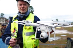
NASA Puts Drone Traffic Management Through Stress Test
Drones delivering packages to a doorstep, performing search and rescue or monitoring agriculture used to seem like a scene from a Sci-Fi movie, but with increasing affordability and accessibility of drones, it's not too far off from reality.
For example, within two years the FAA will be required to authorize package deliveries by drones and create a "air carrier certificate" for operators of these drone delivery fleets, according to a new Senate bill. But, even with those plans in motion, there is currently no infrastructure to support a wide-spread traffic management operation like that safely.
The Unmanned Aircraft System (UAS) Traffic Management (UTM) is a research platform, conducted by NASA and the Federal Aviation Administration (FAA), meant to enable low-altitude airspace operations.
“NASA is developing forward-thinking solutions to today’s aeronautical challenges with UAS,” Rose Mooney, executive director of the Virginia Tech Mid-Atlantic Aviation Partnership, told airtrafficmanagment.net.
According to utm.arc.nasa.gov, "... the UTM system would enable safe and efficient low-altitude airspace operations by providing services such as airspace design, corridors, dynamic geofencing, severe weather and wind avoidance, congestion management, terrain avoidance, route planning and re-routing, separation management, sequencing and spacing, and contingency management."
There are two possible types of UTM systems NASA is envisioning, according to their research website: Portable and Persistent.
The Portable UTM system would move from between geographical areas and support operations, such as disaster relief. The other, Persistent UTM, would provide continuous coverage for a geographical area.
Human operators would not be required to monitor every vehicle continuously in either plan.
The testing for the technology, lead by NASA, is taking place in four stages of a series called Technology Capability Levels (TCL).
In stage one, which concluded in August 2015 and is undergoing additional testing with the FAA, technologies in operations for agriculture, firefighting and infrastructure monitoring, with a focus on geofencing, altitude "rules of the road" and scheduling of vehicle trajectories took place.
This month NASA and the FAA conducted the first, and largest, demonstration of the UTM platform. It flew 24 drones, of which 22 flew simultaneously. The test was considered successful because the original criteria only called for 16 simultaneous operations.
“We didn’t have any testing problems today,” Parimal Kopardekar, lead of NASA’s UTM efforts, told airtrafficmanagment.net. “NASA extensively tested Technical Capability Level one and worked very closely with the FAA test sites, and the UTM research platform performed well. This test would not have been possible without the six FAA test sites – it was a collaborative effort to ensure a successful test.”
The second stage, scheduled for October 2016, will focus on "beyond-visual line-of-sight" operations in sparsely populated areas.
In January 2018, the third stage, which will focus on testing technologies that maintain safe spacing between responsive and non-responsive UAS over moderately populated areas, is scheduled to take place.
Finally, the last stage in NASA testing before results are transferred to the FAA in 2019 for further testing, will focus on operations in higher-density urban areas for tasks such as news gathering and package delivery. It will also test technologies that could be used to manage large-scale contingencies.
About the Author
Vesna Brajkovic
Vesna Brajkovic, who grew up around pilots and aviation mechanics, creates digital content for AviationPros.com. She recently graduated from the University of Wisconsin-Whitewater. When she's not writing about the aviation industry, you can find her freelancing for MyCommunityNow-Lake Country (USA Today Network). She can be reached at [email protected].
