Winter brings many new challenges to ground support services. Not only do temperatures drop, but freezing and frozen precipitation can cause many problems. This can range from impeding airport operations to delaying or cancelling flights to even shutting down the whole facility. Unfortunately, we can’t control the weather. We just need to learn what nature may bring us and how best to deal with it.
As temperatures drop, the cold itself can become a problem. The first critical point is when the temperature drops to 32 degrees F. When water freezes, all kinds of problems can ensue. Clearly, even colder temperatures can begin to affect equipment and personnel.
For those who work outdoors, wind is also a factor. The Wind Chill effect is real. Not only do you feel colder when the wind blows (up to 20 degrees F colder than the actual temperature or more), but your body loses heat faster. Exposed skin is subject to frostbite and hypothermia is even possible. Do keep in mind that the Wind Chill only affects people (and animals) not equipment.
For those in the high latitudes, extreme cold in winter is common and is allowed for. But it’s in the lower latitudes, where such cold temperatures are unusual, that the cold causes more problems. Arctic outbreaks occur when the jet stream takes a big dip. This happened repeatedly last winter (2013-14) in eastern North America.
Problems with the cold are minor in comparison with the travails that accompany winter precipitation. Not only are normal operations affected, but safety becomes a significant issue.
AOA
A major concern for airport operations is the condition of the runways. Rain water is one of the most common “contaminants” as referred to by the Federal Aviation Administration. Runways are often grooved, sloped, or crowned to allow rain water to run off. But in the winter, we often have to contend with much more than rain. Snow, sleet, and freezing rain are common in the colder climates and even occasionally in areas typically warmer. And water in its frozen form will not drain off on its own.
Actions must be taken to keep the runways safe and usable. According to the FAA, “a contaminated runway has more than 1/8 inch of slush, snow, or compacted snow, ice, or frost covering more than 25 percent of the required length and width of its surface.” It takes very little time, sometimes only minutes, for 1/8 inch of frozen or freezing precipitation to accumulate. Only if the air or ground surface temperatures are above freezing will we get melting from below and runoff.
Snow is the most common type of winter precipitation. Snow is made up of ice crystals. The consistency of snow varies as will the problems it causes. Temperature is a major factor. With temperatures well below freezing (and, yes, it is never too cold to snow), the snow has a lower water content. This “dry” snow is lighter and does not adhere to surfaces that much. It is more easily removed. Even when accumulated, dry snow has some traction. On the downside, this type of snow is more prone to blowing and causes visibility problems.
With temperatures closer to freezing, the snow is wetter. (Keep in mind that snow is produced in clouds well above the ground. It can snow with surface temperatures above freezing, even in the 40’s.) Wet, mushy snow is slippery and greatly reduces runway traction. It also sticks to surfaces and would have to be removed from aircraft. At least, it’s less likely to blow around.
How bad things get and how fast they get bad depends on the snowfall rate. Snowfall is considered heavy when it falls at a rate of one inch per hour. This is typical in a winter storm. At that rate, a runway would become “contaminated” in less than 10 minutes. Convective snows such as the infamous “Thundersnow” can fall at rates approaching four inches per hour. Runways and other grounds can become covered in minutes!
Extreme snowfall rates can also bring about the unusual occurrence of accumulating snow with surface air temperatures above freezing. As long as the snow is falling faster from above than melting from below, the snow will accumulate. If the snow slacks off or stops, then it will eventually melt away on its own.
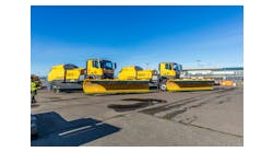
Snowfall rates are also important in snow removal. Snow has to be physically removed from runways and other key areas by snow plows, snow blowers, snow brooms, and even people with shovels. These are very labor intensive, relatively slow processes. If snowfall rates are too great, it becomes physically impossible to remove the snow fast enough to keep runways clear and the airport will have to close until the snowfall lessens. In colder climates where winter storms can be numerous, snow removal costs can be a significant part of airport budgets.
Sleet which is comprised of small ice pellets (actually frozen rain drops) can also accumulate quickly. But it tends to bounce off surfaces rather than sticking to them. And in terms of traction, it’s not as bad as snow.
THE WORST
Probably the worst conditions ground crews will have to deal with in winter come with ice storms. Freezing rain or glaze occurs when liquid water droplets produced in clouds with above-freezing temperatures fall into a shallow layer of air with below-freezing temperatures near the ground. The water freezes on contact with a surface producing a layer of ice. On runways, a veneer of ice often with water on top makes braking conditions nearly impossible. Aircraft on the ground can become quickly coated with ice, severely affecting their ability to take off safely. The accumulation rate and severity of the icing is a function of temperature (freezing rain can even occur with temperatures near 0 degrees F) and the intensity of the precipitation.
For freezing rain situations, runways can be treated with salt (like highways) or deicing chemicals. Likewise planes are sprayed with deicing chemicals (often heated) to remove the accumulated ice. There are also anti-icing chemical solutions which can prohibit, at least to some extent, ice accretion to start with. The frequency of application of deicing sprays would be determined by the rate of ice accumulation as affected by the factors described above. The cost of the chemicals and environmental concerns are factors here.
For winter precip situations, the intensity of the precipitation is critical. Weather radar is the best tool we have for determining precip intensity. The colors you see on a radar display actually equate to how hard it is raining or snowing. Green would be light rain. Once you start seeing yellow, then look out for moderate to heavy rainfall. Snow with its crystal structure and lower water content (1 inch of rain equivalent water can produce anywhere from 6 to 30 inches of snow depending on temperature), shows up differently on radar. Blue echoes can be snow reaching the ground. Green indicates significant snow rates. Short term precip forecasts can be made by just examining the radar display and determining where the precipitation is moving.
There are other winter hazards not associated with falling precipitation. Black ice can develop on paved surfaces when temperatures drop below freezing and there is standing water. The ice can be clear and difficult to see and the sheer ice surface is especially slick. Frost, which tends to form on clear and calm nights, can occasionally affect runway traction. Fog is always problematic at airports. The reduction in visibility can often lead to flight delays. Besides your common fog, which is made up tiny water droplets suspended in the air, winter brings two variations. Freezing fog occurs with temperatures slightly below freezing. The fog is still composed of tiny water droplets, but these are “super-cooled”. A number of airports attempt to disperse the fog by seeding it with solid carbon dioxide or with propane gas. “Ice fog” is made up of ice crystals and occurs with much colder temperatures, -30oF or lower. Nothing can be done about it until it dissipates on its own.
Besides precipitation, winter storms usually bring strong winds. They are certainly a concern for aircraft taking off or landing. Often these winds are coming from an unusual direction. For larger airports, alternate runways may have to be used to avoid dangerous cross winds. For smaller airports with limited runways, this is even a greater problem. Strong winds also increase the chances of power outages.
Can meteorologists forecast all of these winter weather situations? If so, how far in advance can warnings be given? The answer to the first question is yes. As for the second question, it depends. Today, weather forecasts are primarily generated by high powered computer models. These “machine produced” forecasts are then tweaked by human forecasters. Winter storms can usually be forecast days in advance. A week at most. Temperatures are somewhat easier to forecast. Even out to 14 days, we can generally tell if it will be warmer or colder than normal. Two weeks out is about the most the computers can forecast. And that’s about it for accurate weather forecasts. Can we tell if it’s going to be a cold winter? Not really. There is some correlation of winter conditions and the El Nino/La Nina cycle in the Pacific Ocean. But the cycle itself is difficult to predict.
About the Author: Dr. Ed Brotak is a retired meteorology professor turned freelance writer. His specialties include weather-related aviation hazards and has written extensively on weather-related threats to aircraft for AeroSafety World.